Volcanoes Today, 7 Nov 2018: Dukono
I bet that was a biggun 7th November 16:02 New Moon
12th 02:21 21.4° S
13th 14:04 Descending Node
14th 15:57 Apogee
15th 14:54 First Quarter
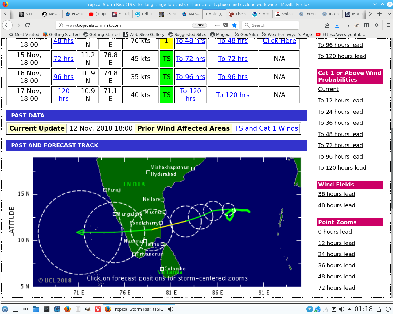
| 12 Nov, 18:00 | 120 hrs | 11.0 S | 51.4 E | 30 kts | TD | To 120 hrs | To 120 hrs | N/A |
Look for swarms including a large quake as Alcide dies.
The Southern Ocean doesn’t concern me as it might I generally look only at the Northern Hemisphere with this globe:
As the cloud-tops darken so the incidence of vapour trails increases and so we are warned by the angels to prepare for storms and eruptions. I forsee a bad moon rising.
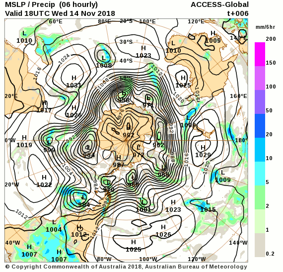
It is so with the Southern Oceans:
And the Hawaiian charts highlight contra rotation the takes place with retrograde stars.
As the Cyan increases so does the smoothness and thus the incidence of vapour lock. If you pay attention to these charts you can gauge the likely times of greatest impacts.
It has been a few hours since the last earthquake approaching the magnitude of a gale: 5.5M. 106km SSE of `Ohonua, Tonga, 6 November 2018. @ 16:11 UTC. I dare say it will be at least 30 of them before the next eruption.
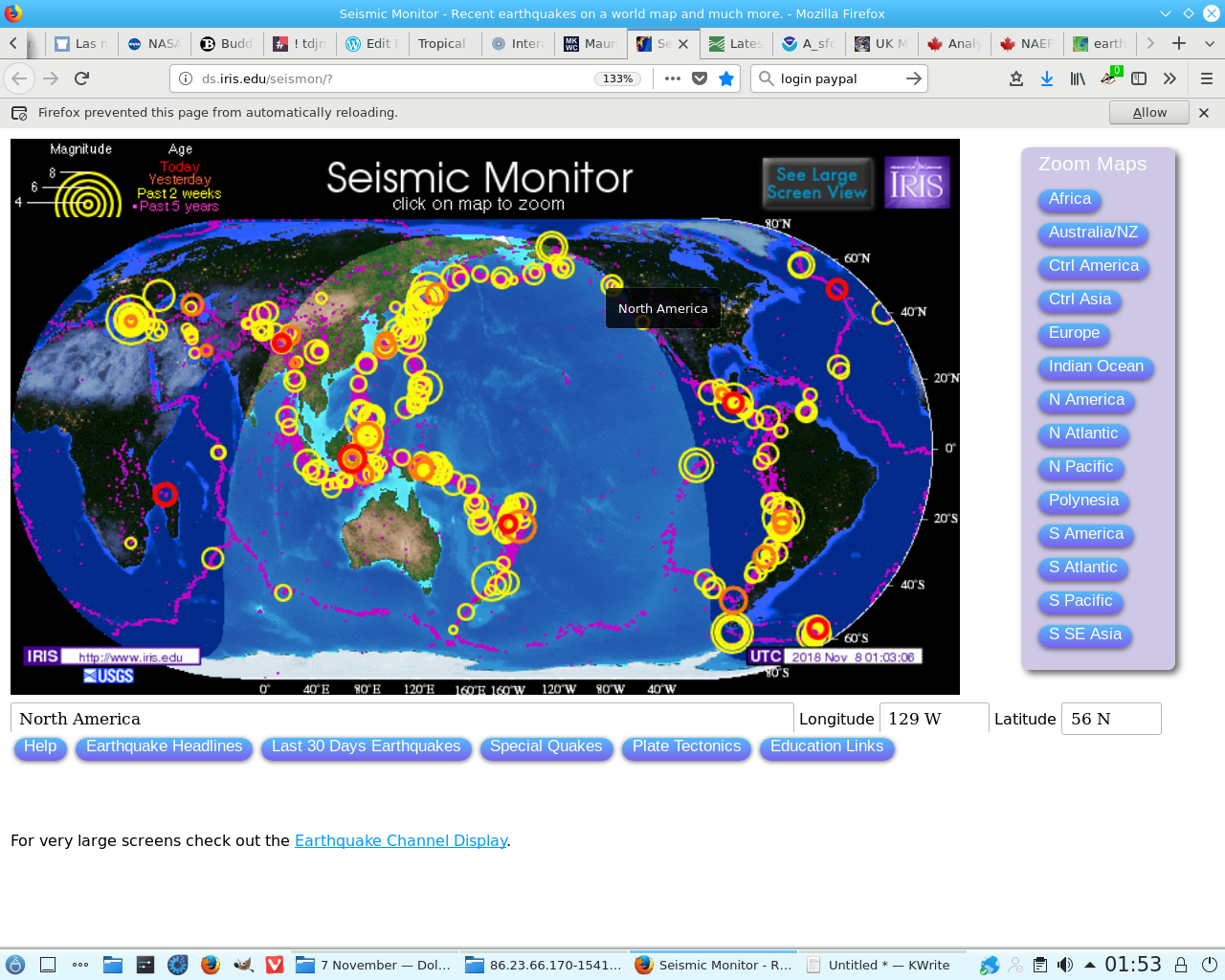
Again the Atlantic appears the most active. Imagine flashing swords not tremors!
The American is showing potential for a tornado if the Greenlander becomes an High.
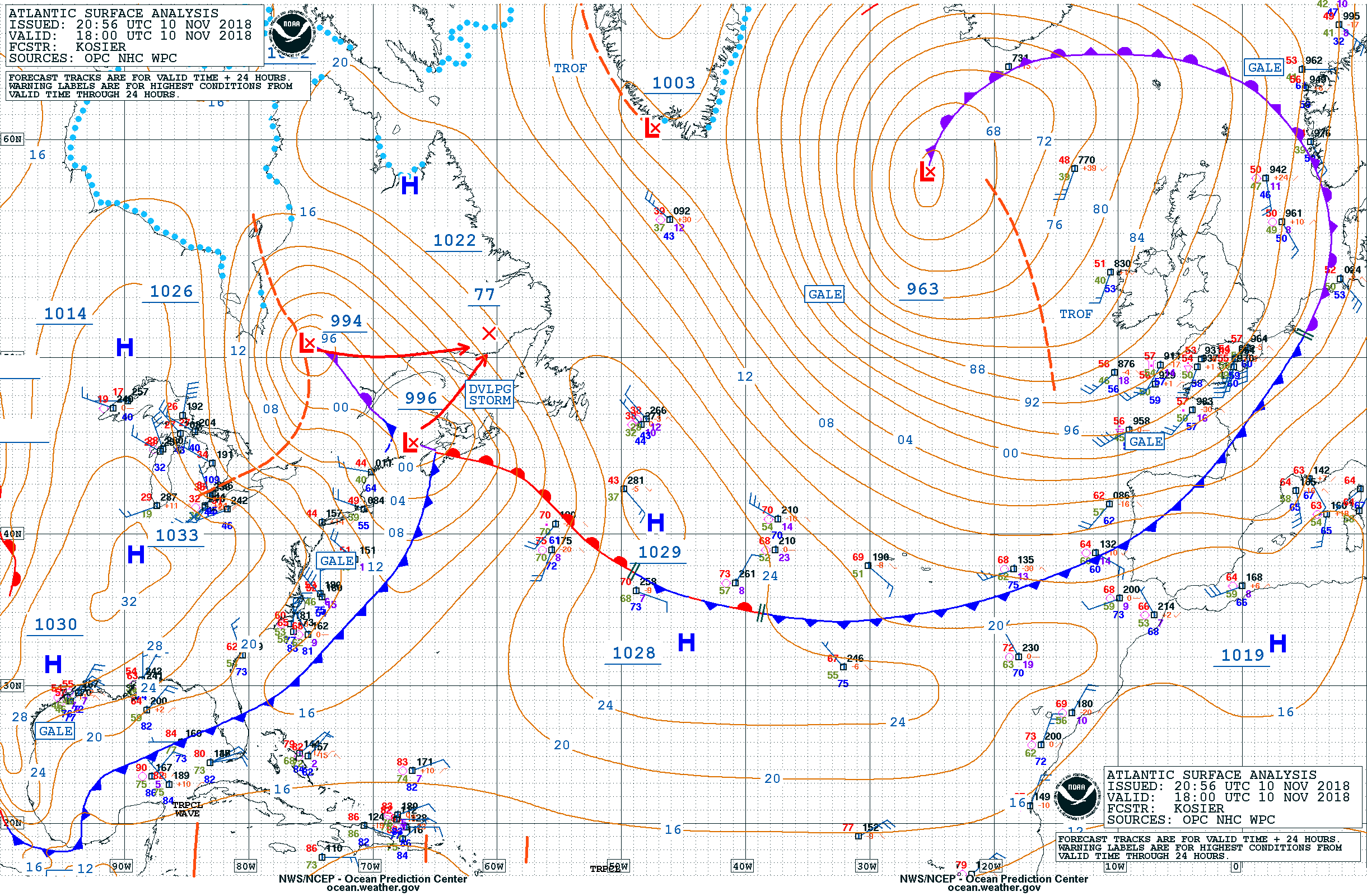
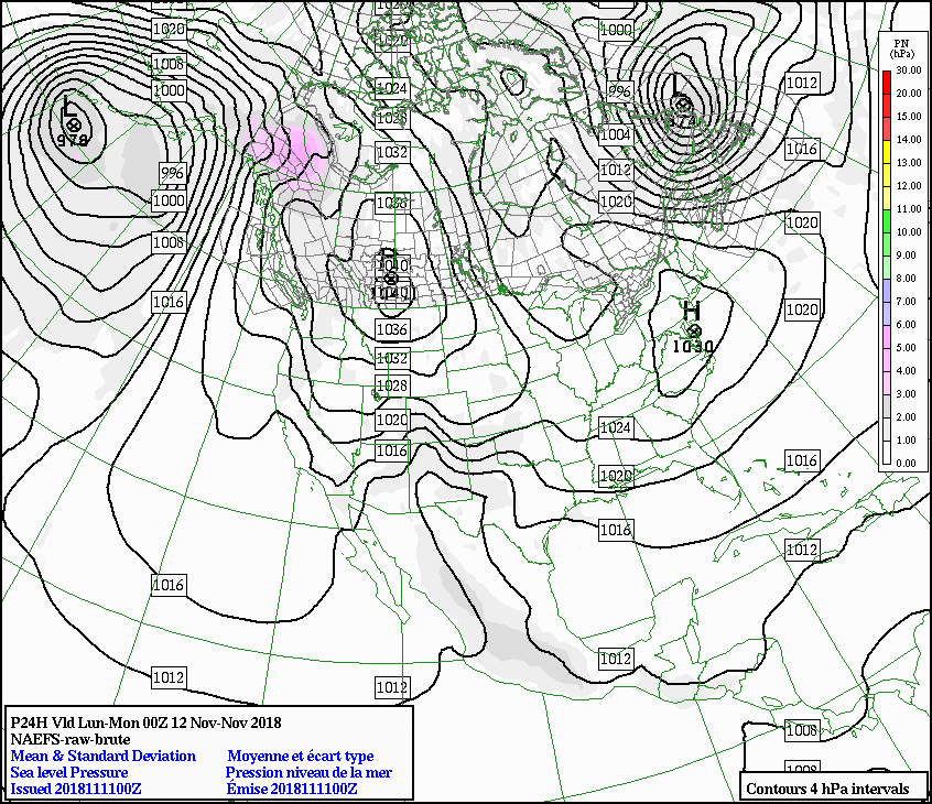
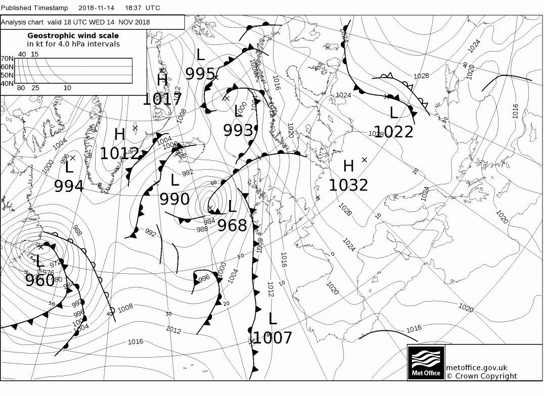
Which it does, on and off, all week. I rather think these Complex Lows are focussed elsewhere though:
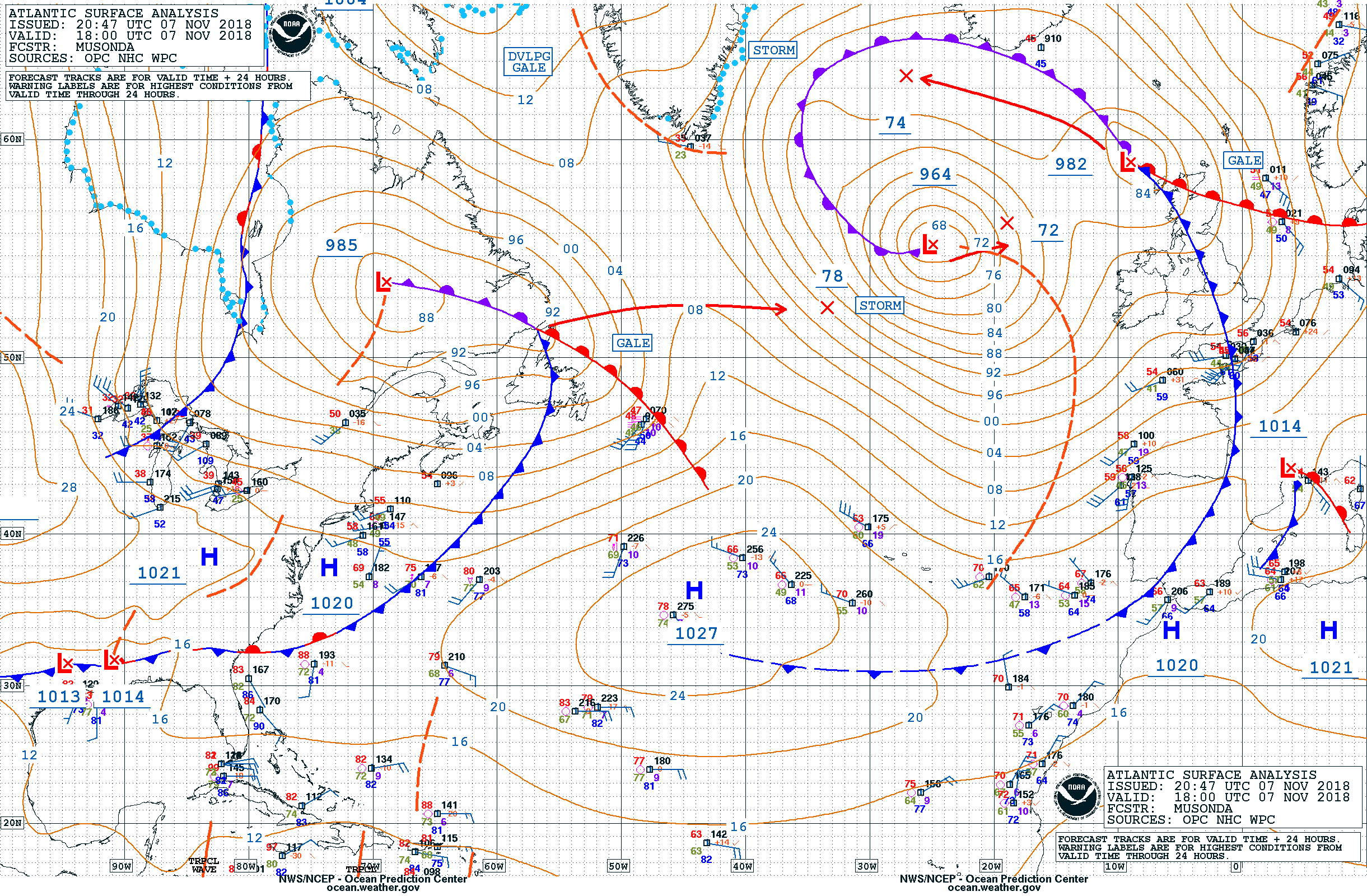
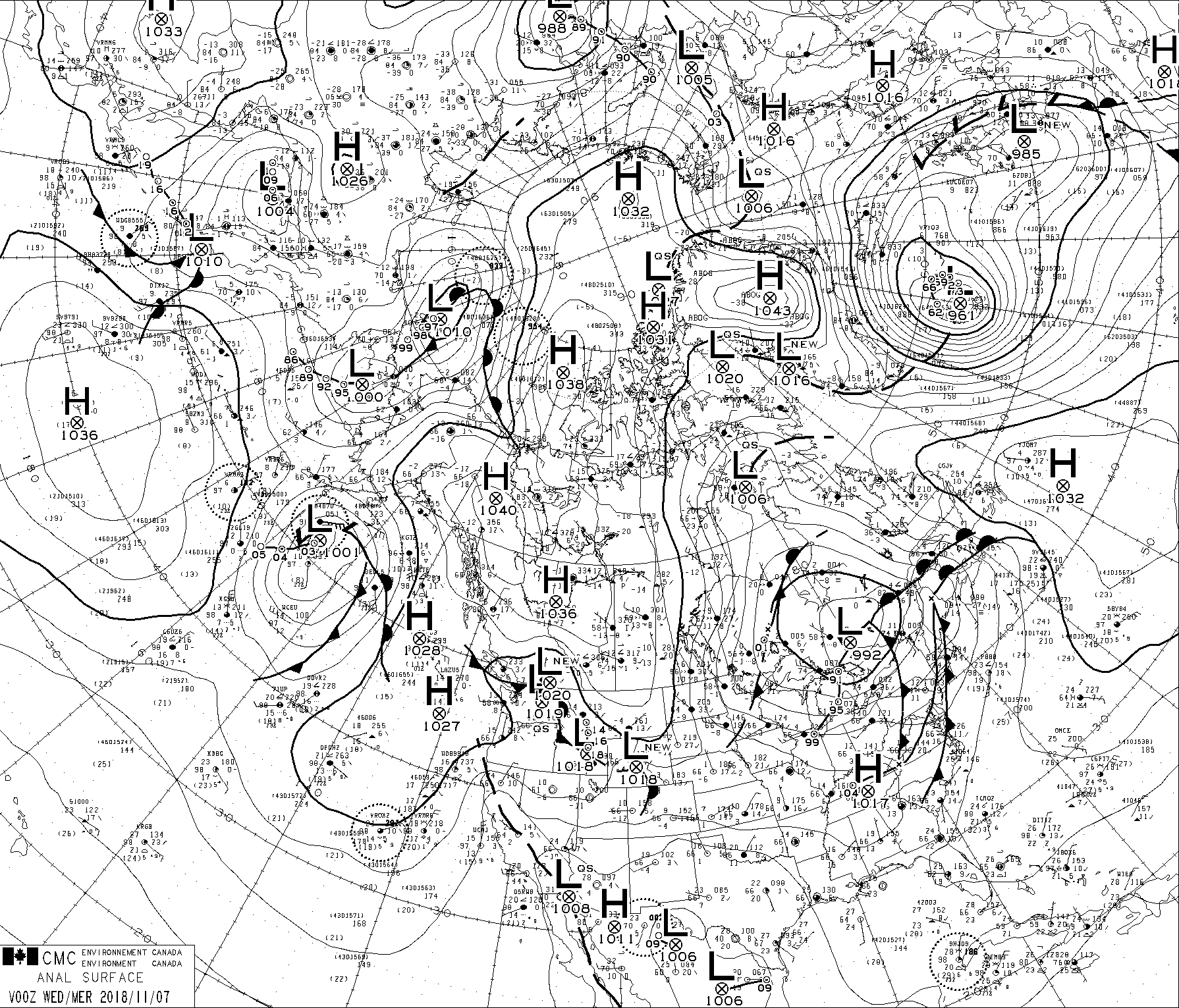
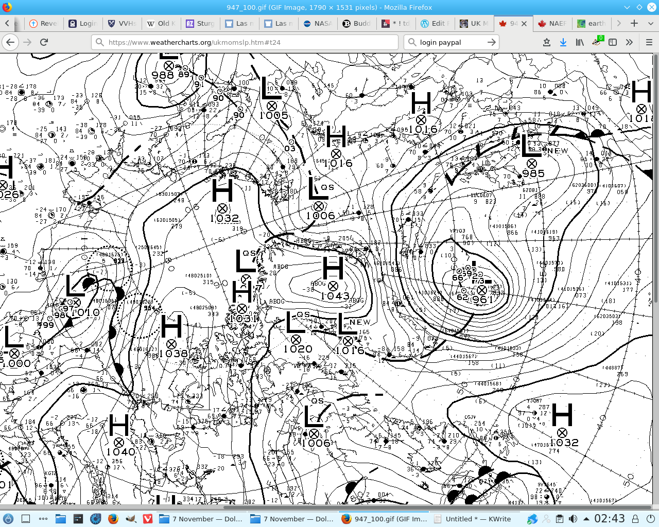
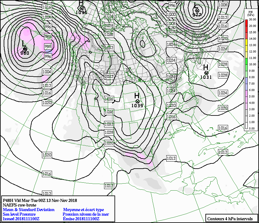
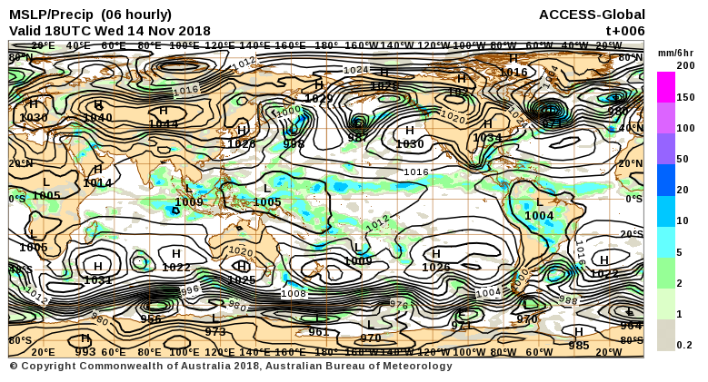
This YUGE High in the Arctic (1043 mllibars) adjacent a deep Low over Greenland (961 millibars) is likely to give us a large earthquake or some memorable Swarms with volcanic eruptions, some 80 degrees from somewhere (or other or 90 from where the 1016 mb line is nearest both?)
What is on a arc some 90 degrees from western Iceland?
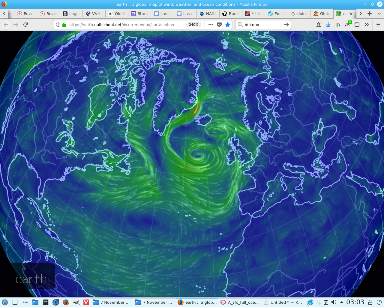
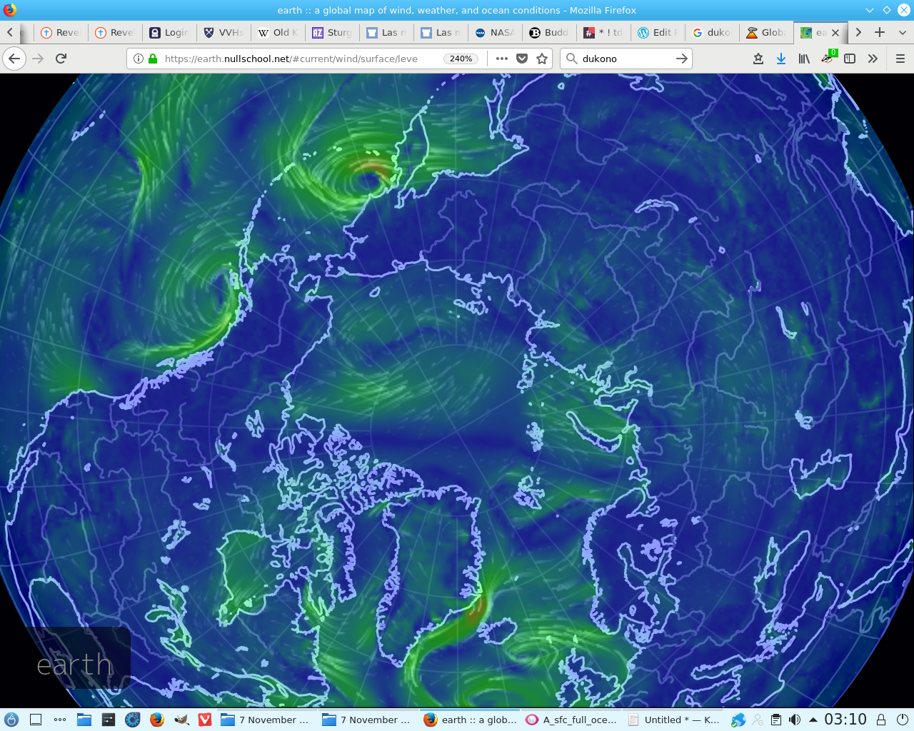
No! Look how many eyes it is spawning:
We may get something on the 10th but the complexiums are all Chinese to me:
Did you notice that in the last post the NAEFS failed just before the eruption of Dukono?
I dare say it will beat:
Based on satellite data, wind model data, and notices from PVMBG, the Darwin VAAC reported that during 30-31 October ash plumes from Dukono rose to an altitude of 2.1 km (7,000 ft) a.s.l. and drifted W and N.
but I am biased against the Linux haters.
The cold winds do blow and we shall have snow what will James Clapper do then, satan’s creature?
He’ll creep from Jeff’s Sessions as he has been warned and watch the survivors pay for his future:
Seriously!
How long can this go on?
8 November 2018. 14:28 for 90 seconds I heard a whistle that was stronger than the sizzling I hear pretty nearly all the time in volcano spells. It faded back into the rest of the noise, leaving the impression of continua. Also the hissing has become more noticeable somehow.
I have heard a couple more to 19:19 must be an all fire afternoon or I am delusional.
Let me guess, this is a complex volcano too: 8 Nov 2018: Reventador I guess I will be spending the coming year rewriting all my blogs.
Volcanoes Today, 9 Nov 2018: Sabancaya volcano and reports are coming on the 10th: Ebeko volcano Volcanic Ash Advisory: ERUPTION AT 20181109/2252Z FL100 EXTD SE REPORTED OBS VA DTG: 09/2250Z
Volcanic activity worldwide 10 Nov 2018: Fuego volcano, Popocatépetl, Krakatau, Dukono, Reventador,…
I think they call this a prial. Three in a row is a flush but in Brag a triangle of threes takes the pot for storms.


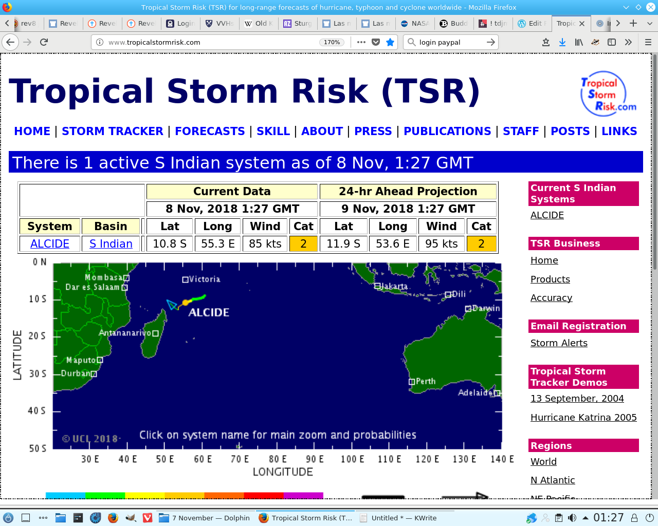
Previously I told you to watch the southern ocean for the development of a volcano (Alcide) this was before I grasped that the Complex Lows give rise to complex volcanoes, so it is any man’s guess what this system is Designed to do. Watch how the contra rotation occurs with some part of these lows separating, it is really interesting:
Watch this triple High over North America from Tuesday it develops, almost magically, into one of the deepest lows in the North Atlantic by Thursday. Can where it breaks the trail on the 1st Qtr tell us anything?
Let’s see how long it takes to tell us more from the Southern Ocean:
How did I know it was going to do that before I looked (I was too tired to look at the charts yesterday. It was all I could do to capture them. My brain was full of squirrels.)
Coincidence?
So a Complex Low gives unity to the Southern Ocean?
Is that a Trump?
I just has to be showing us more. But what?
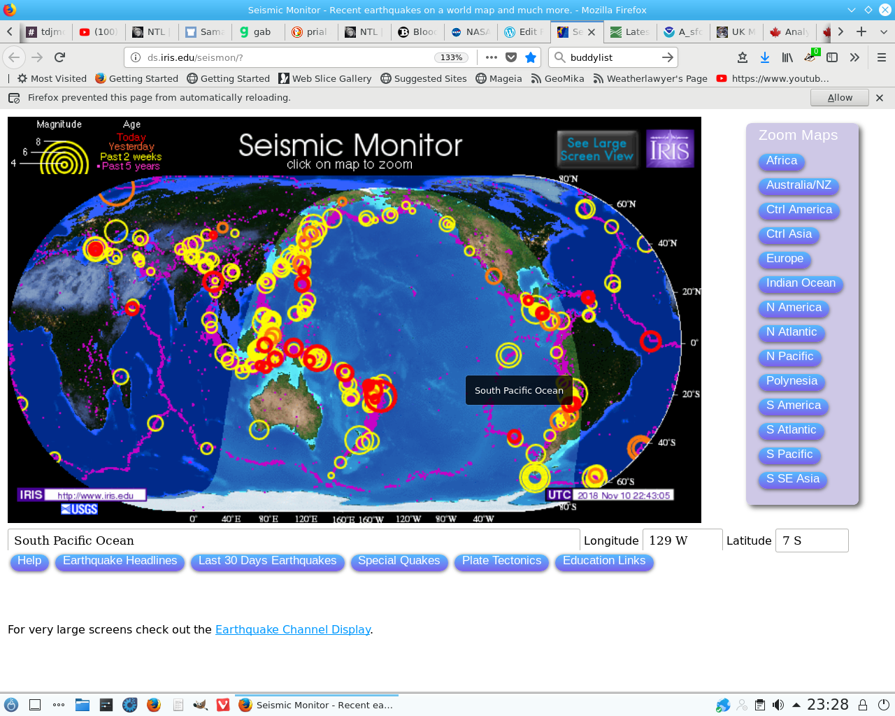
The largest quakes here are on a Great Circle is that a coincidence?
All the way from the Southen Ocean?
Aye, right. Ha. But that doesn’t mean I know what it all means. WHOHoa! Look at this thing.
Where is it going and more important where is it leaving?
Yjis thing is a mirror of what the NorthAtlantic looked like not long ago:
This is just too much for me to cover at once. I have to get hold of it, print it, think about it and get some sleep all at the same time but it is obviously the work of a cartel, so what whoever needs to do is follow the bankrupt property markets.
Volcanoes Today, 11 Nov 2018: Fuego volcano, Popocatépetl, Reventador, Turrialba, Sangay, Sabancaya, Langila Look at the line of Highs:
Darren Prescott first started using the term Complex Low in his commentaries of the day’s weather on uk.sci.weather The first time the Google search returns it was 5 January 2012. Coincidentally, his computer was hit the day before so there was a complex volcanic eruption I guess. It was an active year but I can’t find his one:
https://www.theatlantic.com/photo/2012/12/2012-the-year-in-volcanic-activity/100423/ Sort through them for yourself. Try Puyehue-Cordón Caulle volcanic complex, Patagonia. https://www.gns.cri.nz/static/pubs/2012/SR%202012-020%20Print%20Copy.pdf
Volcanoes Today, 12 Nov 2018: Reventador volcano IIRC this was a complex one too. Dukono volcano Volcanic Ash Advisory: CONTINUOUS VA EMISSION TO FL060 EXT NNE EST VA DTG: 13/2215Z
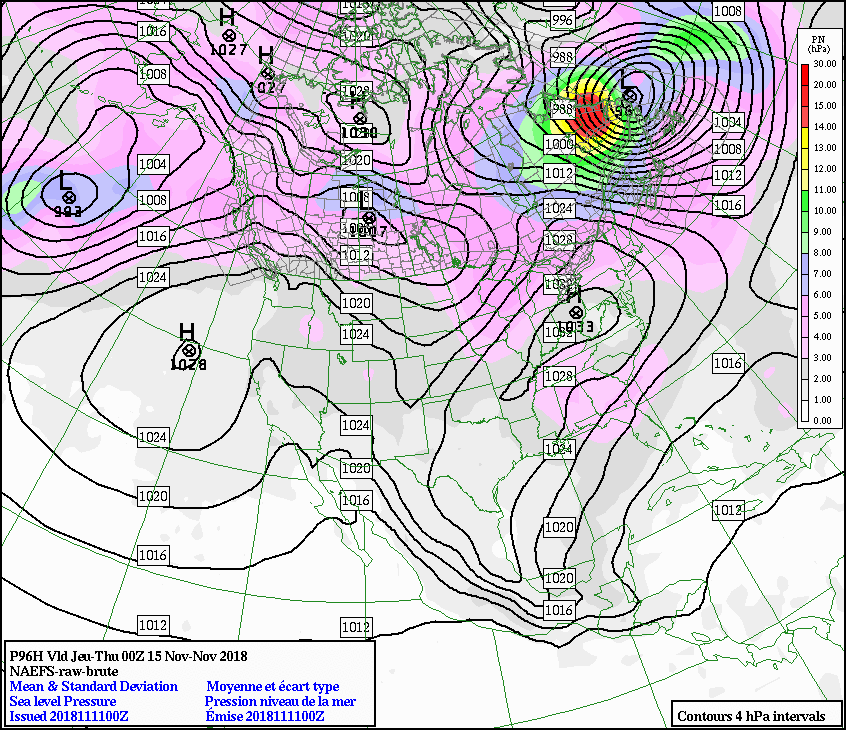
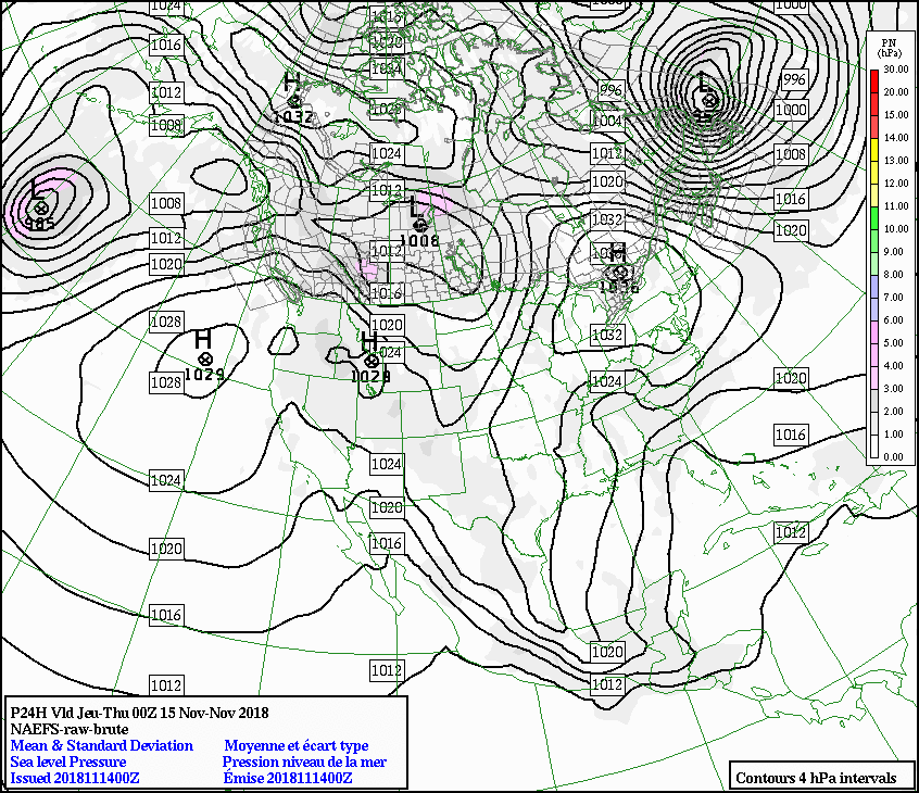
So this is what the Complex Low looks like to the NAEFS:


Guess which wettest place on earth is going to get a soaking?
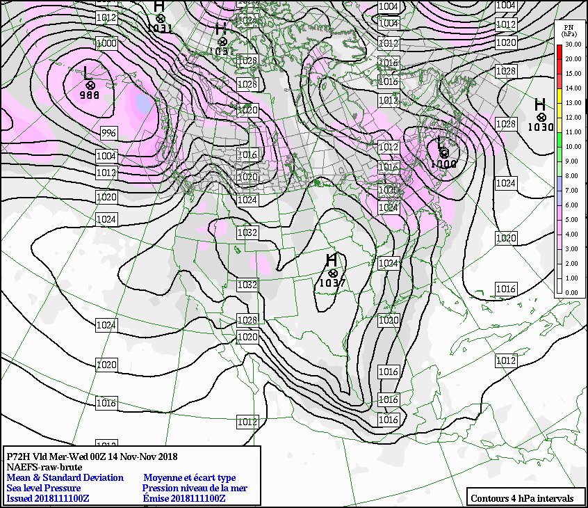
And just in case you have forgotten what a Complex Low looks like in the North Atlantic:
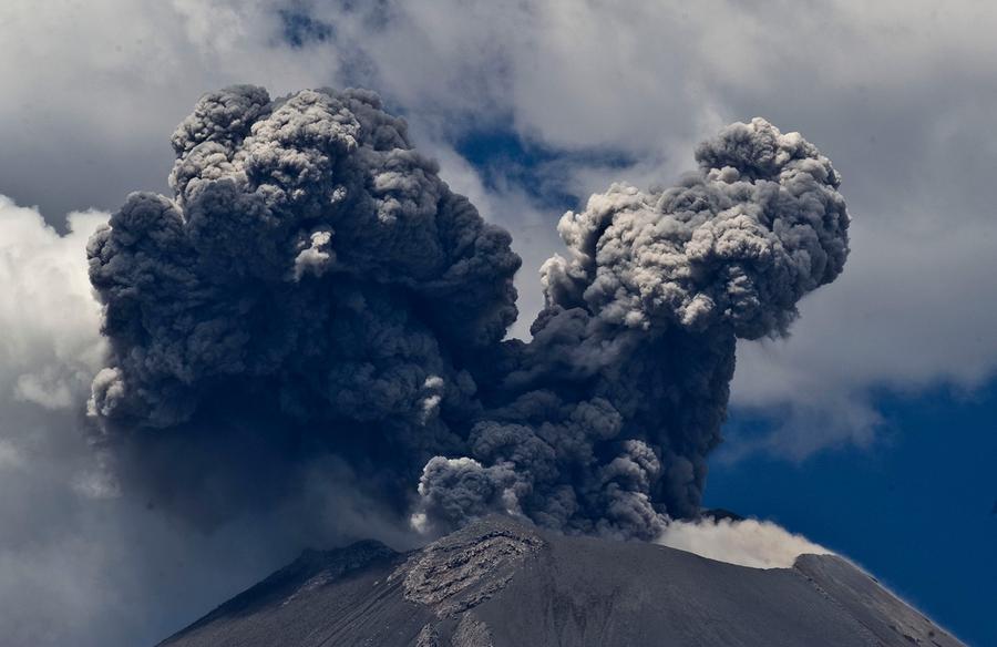
Popocatepetl is indicative of the process of production of lava. You can’t see any trace of rotation in cloud formation, as clouds accept the physics of the environment immediately but as fall out, it is distributed as it arrives. The concentric rings of this image indicate rotation as with a vortex:
https://www.theatlantic.com/photo/2012/12/2012-the-year-in-volcanic-activity/100423/
Volcanoes Today, 13 Nov 2018: Kadovar volcano
My internet connection was disrupted last night. I fell asleep although I heard nothing alarming. Tiredness is a symptom of volcanic activity but obviously the least inspiring.
I am still getting a report of painful ear popping from a friend in Venezuela so whatever else it is it is interesting. I am glad it was someone else though because I have experienced pain from them and it is about as unpleasant as it gets.
13 Descending Node 14:04. What’s a descending node?
14 Apogee 15:57 Venus-Spica 1.5°S 23:23 Can these interact?
15 First Quarter 14:54
16 Moon-Mars: 1.1° N 04:16 These can; in fact the Hawaiian charts light up all over the place.
What is the betting Fuego is a complex volcano system, they seem to dominate all the geo-phenomena when the Complex Low hits and the Icelandic Low sits snugly on the shelf of North America:
And more to come:
I don’t suppose many people know what this is doing: https://gab.com/Weatherlawyer/posts/41125434
The spell is over on the 15th so I will keep it till then. But I am only guessing, anyway. I will point out that the Ross ice is on the right hand side half way down the graphic or half way up, if you are that way inclined. Tis darnundah after all.
I reckon that either Duko or Sakuro-jima are the the one that blows on Friday but I suppose Krakatau is just as likely.
On Friday, 16 November 2018 02:18:10 UTC, Weatherlawyer wrote:
> I don’t know! …
> Sack a bunch of useless duffers or worse: Treasoners, this happens: http://weather.org.uk/resource/ukswxfaq.htm#2B.1
> One has to revert to the less ostentatious but thankfully javascript free of tosh original Martin Rowley FAQs.
>
> How is the old fart?
>
> Darren Prescott annals:
> If anyone has a In with The Donal can you ask him about Darren, please?
>
> On Wednesday, 19 October 2016 23:18:29 UTC+1, Weatherlawyer wrote:
> > On Sunday, 26 December 2004 05:58:18 UTC, Darren Prescott wrote:
> > > Here is a summary of the latest NWP output for noon on Thursday. Issued
> > > 0557z, Boxing Day 2004.
> > >
> > > The outlook is zonal for the forseeable future. High ground in northern
> > > areas may see some snow from time to time as colder air moves swiftly
> > > eastwards, but for much of the UK it looks like a generally mild and wet
> > > spell coming up.
> > >
> > > ECMWF: http://64.246.48.81/pics/Recm1201.gif
> > > Strong westerlies cover the UK as the result of lows to the north and a high
> > > extending from the Azores to the Alps. High pressure builds over SW England
> > > at T+144, resulting in lighter westerlies and SW’lies for much of the UK,
> > > before a trough moves in from the west to bring SW’lies and westerlies at
> > > T+168.
> > >
> > > MetO: http://www.wetterzentrale.de/pics/Rukm1201.html
> > > The Met Office run shows a westerly flow across the UK, with a weak ridge
> > > over England and Wales. The winds become stronger westerlies at T+144 as a
> > > trough moves eastwards towards the UK.
> > >
> > > GFS: http://expert.weatheronline.co.uk/
> > > A weak ridge lies to the west of the UK, with westerlies and NW’lies as a
> > > result. 850hPa temperatures vary from -5C over Scotland and Northern Ireland
> > > to +4C over SW England. SW’lies cover the UK at T+144 as the ridge moves
> > > away to the east, followed by westerlies at T+168. Westerlies continue to
> > > affect the UK on days 8 and 9, with WSW’lies on day 10.
> > >
> > > GEM: http://www.meteocentre.com/models/glb00_120.html
> > > The Canadian run shows a large high over Iberia and westerlies across the
> > > UK. The winds become NW’lies at T+144 as a weak ridge moves eastwards.
> > >
> > > GME/DWD:
> > > http://www.wetter.com/home/img/sat/gme_cl_EU/m/xl/200412250000_120.gif
> > > As with the other runs, high pressure lies to the south of the UK, this time
> > > bringing westerlies for all.
> > >
> > > JMA: http://www.wetterzentrale.de/pics/Rjma1201.html
> > > The JMA is yet another run showing westerlies for all with a strong zonal
> > > flow over the UK.
> > >
> > > NOGAPS: http://129.13.102.67/wz/pics/ngp10.prp.120.europeg.gif
> > > NOGAPS shows mild westerlies for all, again with a large high to the south.
> > >
> > > GM CPTEC: http://www.cptec.inpe.br/prevnum/Global126_sx6_Gl.shtml
> > > Westerlies cover the UK, with a deep low west of Norway.
> > >
> > > KMA: http://www.kma.go.kr/kma03/gif/g21nh_smsr_120.gif
> > > The Korean run also shows westerlies for all.
> >
> > I do hope Darren wasn’t eaten by wolves.
>
> I rather believe he was. Or Vampires. Who was runn…. Ah dickhead cheyne. Yes, they gottim. So why was I spared?
>
> > > zonal for the forseeable future
> > > High ground in northern areas may see some snow
>
> This meant a complex Low produced volcanic eruption this just the one making the front page then. I recall that there was such a thing was it in the Philippines?
>
> > > high extending from the Azores to the Alps. High pressure builds over SW England at T+144
>
> If god spare me and I have the time I shall post all the updates to these links that I can find in tribute to the one seen fit to fell.
>
> > > KMA: http://www.kma.go.kr/kma03/gif/g21nh_smsr_120.gif The Korean run also shows westerlies for all.
>
> And of course …What was I going to say here?
> Something about the North Korean settlement, no doubt.
>
> Manam[VEI 4] Papua New Guinea 2004 I am pretty sure there was another one around the time of the SuperQuake. So the death penalty for the quake included Darren did it?
>
> In November 2004, a major eruption forced the emergency evacuation of over 9,000 inhabitants of the island. The eruption began October 24 but was not seen as a major threat until the wind changed pushing ash and debris towards inhabited areas. Five people died during the eruption. On December 11, the threat was downgraded due to a reduction in activity.
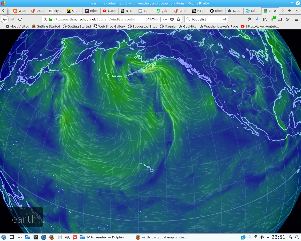
Beautiful. He would have loved this:https://earth.nullschool.net/#current/wind/surface/level/orthographic=-26.50,52.98,289
That’s me finished with WordPress. I can’t make any sense of the new controls. I am off to Altervista where i presume I still have a choice of what miserable wretchedness i choose to print

